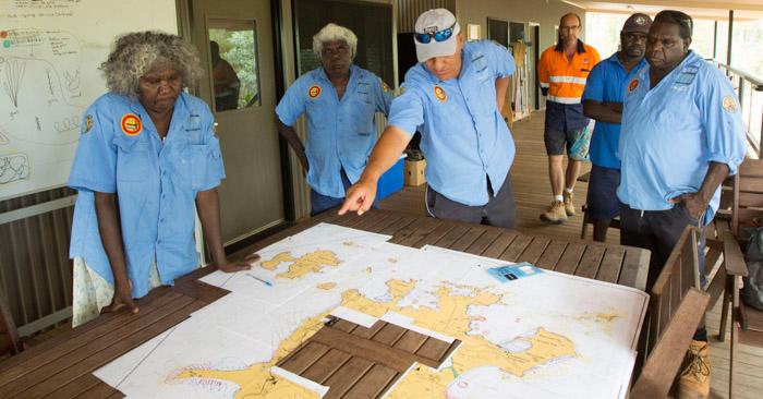
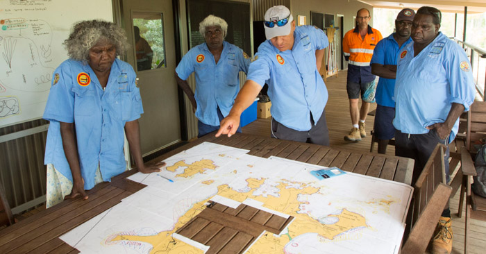
The largest mapping and research project of its kind has given traditional owners of Groote Eylandt, in the Northern Territory, the tools to better manage and protect their sea country.
The three-year project entitled Mapping the `Makarda’ (sea country) is a partnership between Australia’s tropical marine research agency the Australian Institute of Marine Science (AIMS), and the Anindilyakwa Land Council.
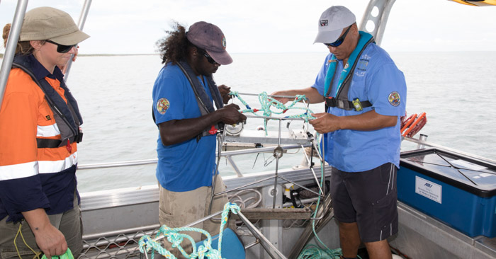
ALC Rangers and AIMS researchers, worked together on both sea Ranger vessels and onboard AIMS’ largest research vessel the RV Solander, to map Groote Eylandt’s deeper coastal habitats using a high-tech multi-beam sonar, and the European Space Agency’s Sentinel 2 satellite system to map shallow inshore areas.
AIMS’ project leader Dr Ben Radford said together, they had mapped 3200km2 of ocean floor, an area nearly twice the size of Groote Eylandt, Australia’s fourth largest island. Maps have been developed and translated into traditional language, and these are being delivered to the community this week.
“We used Baited Remote Underwater Video Stations (BRUVS) at 212 sites and we found the diversity of fish species was 53% greater than previously recorded in shallow areas of Groote Eylandt,” Dr Radford said.
“This study found 239 fish species at Groote Eylandt, similar in diversity to those found at some inshore areas of the far northern Great Barrier Reef, identifying it as an important ecological area in the region.
“The Anindilyakwa rangers and elders worked with us to share their people’s traditional knowledge from 8000 years living in the area, and we were able to share the latest in science and technology to map diversity hotspots and key habitats around the island.”
Anindilyakwa Land Council Chairman Tony Wurramarrba said improving the understanding of the marine environment in the Groote archipelago would allow for better management of the natural resource, as well as economic development potential for conservation, tourism and aquaculture.
“Even though we know what is going on there culturally, working with AIMS meant we could actually see what is happening under the water, so we can manage fisheries and the protection of this area for future generations to come,” Mr Wurramarrba said.
“We depend on the sea for our food and we have close cultural ties with the sea, so it is very important to us.”
ALC Sea Ranger Jenifer Yantarrnga said the rangers had gained many skills over the life of the project, including surveying and monitoring techniques, and unique experiences including working onboard a world-class marine research vessel.
“Our aim was to document the habitats and species in the Indigenous Protected Area of the archipelago, so we have a good baseline of information to help us better manage our sea country, and we have achieved that, so it is a great outcome.”
AIMS’ research team returns to Groote Eylandt from August 26 to 30, to deliver a series of maps of the `Makarda’ which includes information on the fish and iconic marine species which live there.
The maps and a series of Ranger training videos have been translated into traditional language with the help of the rangers.
Media Contact
Corporate Communications and Public Affairs - Media Officer
Emma Chadwick: 0412 181 919 or e.chadwick@aims.gov.au
Photos and video available:
https://cloudstor.aarnet.edu.au/plus/s/826gbt0MGe1n7zL


