The challenge
Teasing out the performance of the marine economy from the rest of the economy is very difficult. Most monetary statistics measure the economy as a whole, and even those specific to marine industries can include a mix of onshore and offshore activity.
It’s particularly challenging at a local level, with much of the available data relating to the national economy as a whole.
The approach
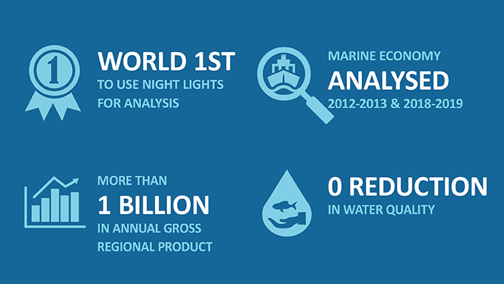
In a world-first study, AIMS scientists used satellite images of Darwin Harbour at night to calculate the size of the harbour’s marine economy.
The pioneering technique blacks out the land and measures the amount of light between the beach and the edge of a nation’s ocean territories. It includes light from oil and gas operations, shipping and fishing, as well as light spill from coastal populations.
It’s not the first time light has been used to study economic activity. The dark skies over North Korea, for instance, have long been interpreted as a sign of the country’s isolation. But the AIMS study was the first in the world to measure the marine economy by spatially partitioning land and sea.
The AIMS team also tested the night light technique on other parts of the world where the blue economy has been comprehensively measured. They found analysing the publicly available satellite images was as good as any other method of estimating the marine economy.
The impact
The AIMS analysis showed Darwin Harbour’s gross regional product rose from $1.3 billion in 2012-13 to just under $2.4 billion in 2018-19. Over the same period, the harbour’s contribution to the greater Darwin economy rose from 8.9% to 12.7%.
Importantly, the economic expansion has not come at a cost to the environment, with no decrease in water quality and other environmental measures during that time.
The research used to enable the sustainable development of the harbour expanded more quickly after AIMS established a Darwin office in 2005. This saw an immediate increase in fundamental knowledge of the harbour, including its oceanography, sediment base and historical impacts.
This research has been used for planning and other strategic decisions, with AIMS heavily involved in advisory bodies, consulting and stakeholder engagement in Darwin Harbour.


